Muirhouse
Introduction
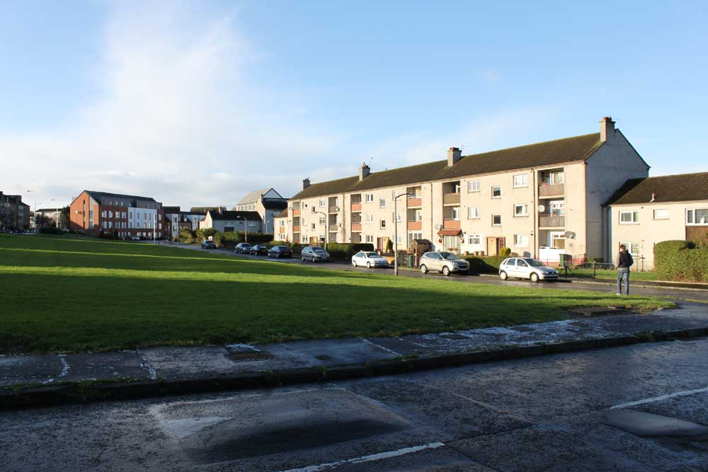
The name Muirhouse was apparently recorded as far back as 1336. The name was used for a large house, Muirhouse, built in 1830. A previous house of the same name had been in a different location, near Muirhouse Mains farm, which can be seen on the 1933 map. The area was developed, started just after World War II, with houses built by Edinburgh Corporation. This followed development of the adjacent Pennywell area. The first part of the development can be seen on the 1952 map.
A photograph of some of the flats from this era can be seen on flickr![]() .
.
Since 1992, many of the houses in the area have been bought by Muirhouse Housing Association![]() and the area has been improved. This has included demolition of some buildings and construction of new houses on the cleared sites.
and the area has been improved. This has included demolition of some buildings and construction of new houses on the cleared sites.
The area includes a number of multi-storey blocks, dating from approximately 1960, including two fifteen-storey blocks (Birnie’s Court and Fidra Court), two nine-storey slab blocks with balcony access (Gunnet Court and May Court), and two eleven-storey blocks with balcony access (Oxcars Court and Inchmickery Court). These were built along Muirhouse Parkway. There are more details and photographs on the Royal Commission on the Ancient and Historical Monuments of Scotland![]() website. These blocks were all named after islands in the Firth of Forth.
website. These blocks were all named after islands in the Firth of Forth.
A further multi-storey block, Martello Court, was later built at Pennywell Gardens and is mentioned on the page about Pennywell.
Immediately east of the built-up area was previously the BT Training College. This was used to train employees, and formerly had a number of ‘telegraph poles’ so that training could be given on overhead line work. In 2009 it was reported in the Scotsman![]() that there were plans to build 200 flats on the site. However, as of December 2011, no work has started.
that there were plans to build 200 flats on the site. However, as of December 2011, no work has started.
Map
Craigroyston Grove
Craigroyston Place
Greendale Park
These three streets were formed in recent years at the western part of the Muirhouse area, off Muirhouse Medway. Craigroyston is a historical name in the area, and was also the name of a nearby mansion house.
Muirhouse Avenue
This street was named on 13 February 1947.
Muirhouse Avenue North
This name seems to have been given in recent years to what was the eastern part of Muirhouse Way, after the street was shortened to form two cul-de-sacs. This part is now accessed from Muirhouse Avenue only.
Muirhouse Bank
This street was named on 12 February 1959.
Muirhouse Close
Muirhouse Crescent
This street was named on 9 April 1964..
Muirhouse Drive
This street was named on 9 February 1956.
Muirhouse Gardens
This street seems to date from about 1956.
Muirhouse Green
This street was named on 12 February 1959.
Muirhouse Grove
This street was named on 9 February 1956.
Muirhouse Loan
This street was named on 9 February 1956.
Muirhouse Medway
This street was named on 27 November 1958.
Muirhouse Park
This street was named on 12 February 1959.
Muirhouse Parkway
This street was named on 9 February 1956.
Muirhouse Place East
This street was named on 13 February 1947.
Muirhouse Place West
This street was named on 13 February 1947.
Muirhouse Terrace
This street was named on 9 February 1956.
Muirhouse View
This street was named on 6 April 1961.
Muirhouse Way
This street was named on 9 April 1964.


