Boswall area
Map
Introduction – Boswall
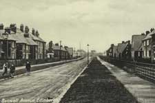
These streets, together with the Fraser and Grierson streets, were mainly laid out in the 1920s, and can be seen on the 1933 street map. They occupied the area between the existing buildings on the west side of Granton Road and the Wardie Burn, which at the time was a ward boundary, is shown in red on the map. The Wardie Burn had, between 1896 and 1920, been the boundary of the City of Edinburgh.
When this area was built, there were open fields to the west, covered a few years later by the Pilton area.
These streets contained houses built by Edinburgh Corporation, following the Housing (Scotland) Act 1919 which made local authorities responsible for providing working class housing and made Government subsidies available for the purpose.
The streets were named after the Boswall family, who had owned the Wardie estate.
Boswall Avenue
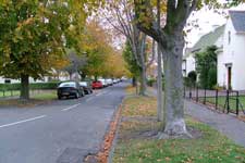
Boswall Crescent
Boswall Drive
Boswall Gardens
Boswall Green
Boswall Grove
Boswall Loan
Boswall Parkway
The above streets were all named on 24 November 1921.
Boswall Parkway was laid out as the central street of the developing area, running east to west and connecting at the east end with Wardie Crescent and at the west end with Crewe Road North. By the late 1930s it contained two schools, Granton Primary and Royston Primary, and five churches.
Boswall Place
This street was named on 26 March 1931.
Boswall Quadrant
This street was named on 24 November 1921.
Boswall Road
Boswall Road is included in the page about Wardie.
Boswall Square
This street was named on 24 November 1921.
Boswall Terrace
This street was named on 24 November 1921.
Introduction – Fraser
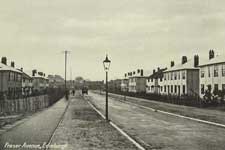
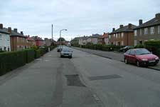
Unlike the Boswall and Grierson streets, where the houses were of conventional masonry construction, the houses in this area were built of steel. This can be seen in the photographs below, of Fraser Avenue. This was part of a government-sponsored scheme involving the Second Scottish National Housing Company (Housing Trust) Ltd. The streets were named after Provost Fraser of Dunfermline, who was one of the directors of the company. Similar houses were built at Findlay Avenue, off Sleigh Drive in the Craigentinny area – Sir John Findlay was the company’s chairman. Many of the houses have since had a masonry skin added externally to improve their insulation.
Fraser Avenue
Fraser Crescent
Fraser Gardens
Fraser Grove
The above streets were all named on 22 October 1926.
Introduction – Grierson
These streets were named after Sir Andrew Grierson, who was Town Clerk of the City of Edinburgh from 1918 to 1934. These streets are to the north-east of the Boswall streets.
Grierson Avenue
Grierson Crescent
Grierson Gardens
Grierson Road
Grierson Square
The above streets were all named on 7 May 1925.
Grierson Villas
This street was named on 29 July 1926.


