Local authorities boundary map
Move your cursor over the dates at the foot of the map to see the boundaries defined at that date.
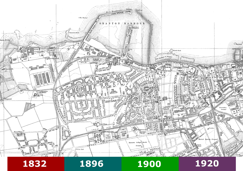
Base map: Bartholomew’s Plan of Edinburgh and Leith, 1940-1941, courtesy of mapseeker.co.uk
Move your cursor over the date tabs below to see an outline of the changes at each date.
The boundaries established in 1832 followed a review of burgh boundaries throughout Scotland, which was put into law by the Great Reform Act.
At that date, many of the present streets and other features did not exist. For example, Granton Harbour and Granton Road had not been built. Ferry Road (then called Queensferry Road) was used as one of the boundaries of Leith, but other boundaries were simply straight lines drawn on the map between defined points.
The changes in 1896 were part of a general expansion of the City of Edinburgh, which included absorbing Portobello and Corstorphine into the city. The area west of Granton Road was not built up at the time, and was used for nurseries which grew fruit and vegetables.
The western side of the ‘triangle’ followed the Wardie Burn which was also the boundary of St Cuthbert’s parish.
This extension of Edinburgh brought the recently built Leith Fever Hospital (later the Northern General Hospital) on Ferry Road inside the city boundary. The hospital had been built well outside the built-up area of Leith to minimise the spread of infectious diseases.
In 1900 some smaller areas were taken into the city. These included the site of Granton Gas Works which was being built at the time. When the site was bought by the Edinburgh and Leith Corporations Gas Commissioners – a joint undertaking by the two local authorities – it was in neither Edinburgh nor Leith.
Leith was amalgamated with Edinburgh on 20 November 1920. The amalgamation had been proposed in the 1890s but rejected. However, by 1920, Leith had become hemmed in by extensions of the city of Edinburgh and had no scope for expansion.
From 1975 to 1996 Edinburgh (and the rest of Scotland except Orkney, Shetland and the Western Isles) had two-tier local government. Edinburgh was administered by the City of Edinburgh District Council and, with Midlothian, East Lothian and West Lothian, was also in Lothian Region. Edinburgh District was enlarged from the former area to include South Queensferry, Kirkliston and other areas to the west of the former boundary.
Since 1996 Edinburgh has again had a single-tier authority, the City of Edinburgh Council.
Further information
For further information, you may wish to visit the National Library of Scotland maps pages using the link below.
Acknowledgement
I am very grateful to Jessie Denholm for her help with this page.
David King, Webmaster