1896 map 10
To see more detail, move your cursor over the map, and an enlarged rectangle will appear. Use your mouse wheel or equivalent to change the level of magnification. The map is made up of four parts, which will magnify separately.
Reproduced from 1896 Ordnance Survey® map (original scale 1:2500, equivalent to 25.344 inches per mile)
I am very grateful to Scott Brown, former proprietor of the Starbank Inn, for lending the original.
Interesting features on this map
This map shows a number of interesting features.
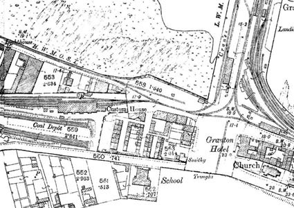
At the left of the map is the Caledonian Railway approach to Granton Harbour and the goods station, next to the Custom House.
Granton Square, with the Granton Hotel on its east side (now HMS Claverhouse) can be considered the centre of Granton.
East of Granton Square, on Granton Road, is the former Granton Parish Church.
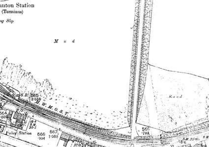
In the upper part of this map is the Middle Pier, the first part of Granton Harbour to be built. The railway (the North British Railway at the date of this map) approached the harbour from the east, running alongside Lower Granton Road. Near the top of the map is Granton Station, which was a passenger station until 1925 with trains from Edinburgh Waverley, and next to it is the berth that had been used by the train ferries, which had stopped running a few years before this map was published.
South west of Granton Square is the former Granton School, which had various subsequent uses.