Leith boundary map
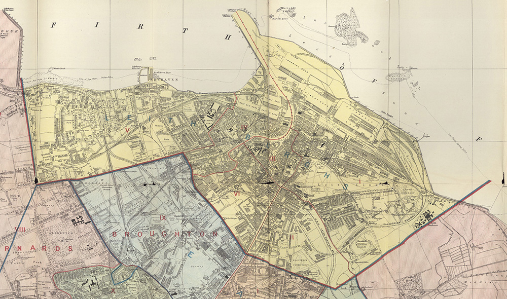
As far as I can determine, the boundary shown on this map was the boundary of Leith from 1832 (the date of the Reform Act) until amalgamation with Edinburgh in 1920. The map also shows the Leith municipal wards, from I to VI, in red.
For further information, you may wish to visit the National Library of Scotland maps pages using the link below.
Direct link to the Edinburgh City section of the NLS website, which links to numerous maps from various dates