1896 map 18
To see more detail, move your cursor over the map, and an enlarged rectangle will appear. Use your mouse wheel or equivalent to change the level of magnification. The map is made up of four parts, which will magnify separately.
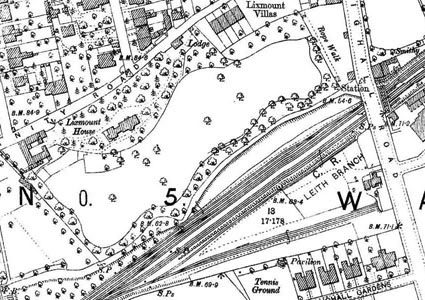
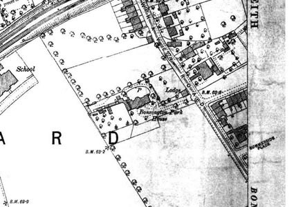
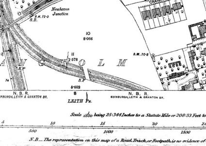
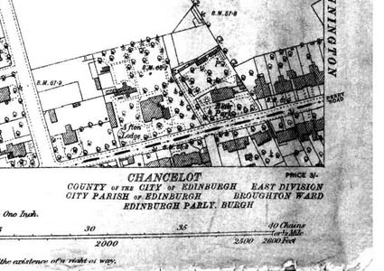
Reproduced from 1896 Ordnance Survey® map (original scale 1:2500, equivalent to 25.344 inches per mile)
I am very grateful to Scott Brown, former proprietor of the Starbank Inn, for lending the original.
Interesting features on this map
This map includes an area outside the Granton History Group study area.
Much of this part has already been built up. Near the north west of the map is a large school – then Craighall Road Public School, but soon to be renamed Trinity Academy. It was almost new at the date of the map.
The Caledonian Railway passes across the map, with Newhaven Passenger Station shown, on Craighall Road near the school. Also shown are sidings for goods trains.